“A Sailors Guide to the Windward Islands” by Chris Doyle is a necessity to sail in the Caribbean Waters. He has his own website with lots of useful information. You can by a paper version of the pilot at all islands in every chandler or download a free copy of “A Cruising Guide to the Lesser Antilles 2.0, vol. III, The Windward Islands”, by Frank Firgintino. The Caribbean Compass a monthly free sailing magazine gives a lot of info about the whole area too. You can pick up one at several shops and marinas in the islands or download it. Most cruisers, anchored or docked in Grenada, monitor Ch-68i during the day for routine non-emergency calls. Some monitor Ch-68i overnight for emergency, medical, security and vessel dragging situations. If you have a question, its best asked on Ch-68i. The daily cruiser net is 6 days a week at Ch-66i 7.30 am.
In the information underneath is only highlighting the anchorages/moorings/marinas we have been with our boat “SY Zeezwaluw” (46ft, draft 7ft) since 2016& 2017.
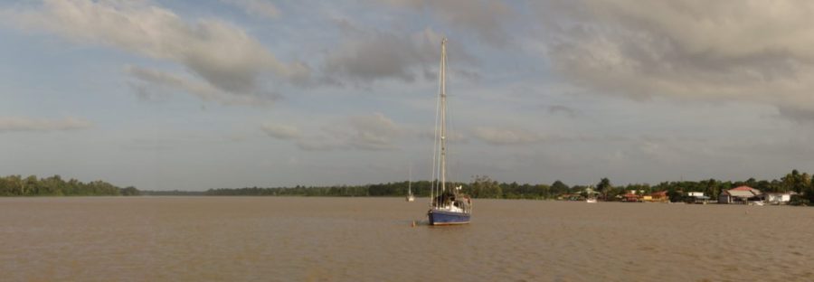
Grenada
Grenada (Pdf file) is the most southern island of the Windward Islands. It’s a very green and lush island and many sailors choose to stay there during hurricane season, at anchor or at a mooring, in a marina or on the hard.  We stayed at own anchor the whole summer of 2016. When the first visa period expires after 3 months, you have to renew it until you leave, every 3 months at the Main Immigration office in Saint George. It is located in the Botanical Garden. The cruising permit can be obtained at every Custom office. The officials are friendly and efficient.
-
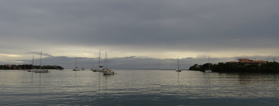
Prickly Bay anchorage, 11°59’.99 N 61°45’.84 W, at the south-side
Prickly Bay is a very large bay. It is convenient to check-in or out of the country because Customs and Immigration are next to the (small) Prickly Bay Marina and opposite the dinghy dock. You can anchor for free or take one of the many mooring balls from the marina or other available renters.
There are 2 dinghy docks; one is at the Prickly Bay marina and one at the Spice Island Yard near Budget Marine. The last one is convenient to take a bus into town or for shopping. Bus nr 1 (with a bus stop near the first roundabout on the way to town) runs all the way up to St. George. At the 6 days a week cruisers net at VHF channel 66i they will announce the schedule and pick-up times for the shopping busses.
Laundry is possible at the marina (no D.I.Y) and expensive. At Spice Island Yard are 2 washing machines and 2 dryers operating on tokens, buy tokens at the security box at the entrance of the yard. Drinking water, diesel and gasoline is available at the marina dock. Garbage disposal is (not always for free) in the bin at the marina or at the Spice Island Yard.
The Tiki bar at the marina is the place of many social events. Restaurant is good. Free Wi-Fi at Tiki bar, with laptop or other devices. There is also Cruisers Wi-Fi at anchor, 40US$/month, slow but workable. Have a look at the internet for how to get it and how to pay. Sometimes it’s rolly in the bay, especially with S-winds. IGA supermarket at Spice land Mall (10 min bus ride) has a good product selection. When you take your boat papers with you, you can get a 5% discount card or a frequent shopper card. At Plaza mall is a fresh bakery & veggie shop. Foodland supermarkets are in St George and opposite the Port Louis Marina.
-
True Blue Bay mooring, 11°59’.82 N 41°46’.13 W, at the south-side
True Blue Bay is just West of Prickly Bay. We took a mooring buoy from the Horizon Charter Company, for approx. 70 US$/week. It is possible and allowed to drop your own anchor near the entrance of the bay or somewhere near the mooring balls, if there are no charter boats on them. The little cove at your starboard side just after entering the bay is also a good spot to anchor but for one boat only. Dinghy dock with water (payable to Horizon Charter Company) is available. Use a little stern anchor for the dinghy when you leave it at the dock otherwise its bumping against the rough dock due to incoming swell. Near the dinghy dock is a little diving shop, and bins for garbage disposal (free), a swimming pool and showers. No washing machines. Restaurant is perfect with lots of special food events and happy hour rum punches.
Free Wi-Fi from the restaurant. Every day a different login, this is written down at a notice board in the restaurant. Staff of the restaurant is helpful and friendly.
There is a little supermarket with the basic daily products as bread and so on and a pharmacy along the road from True Blue Bay to Spice Island Yard. The bus (nr 1) stop to Saint George is the same as the one from Prickly Bay, so a long walk.
-
Woburn Bay anchorage, 12°0.51’ N 61°44’.16 W & 12°0.43’ N 61°44’.25 W, south-side
The entrance to Woburn Bay or Clarks Court Bay is 6 Nm east of Prickly Bay. The entrance is well buoyed and lit and easy to follow even at night. There are 2 shallow parts in the bay; one is well marked by poles (no lights) near the Calviney cut. The second one is not marked with buoys or poles but it is marked on the digital charts. The shallow part is in the middle of the path to Clarks Court Marina and Boat yard just South East of Whisper Cove Marina and north of the Hog Island cut.
The bay is very sheltered due to the reef in front of the bay. Even with SE or S winds hardly any swell enters the bay, only the long fetch might give some little waves.
We have been anchored here for nearly 3 months during Hurricane season 2016 and liked this bay very much. There are many possibilities to go by dinghy to the other bays and to Hog Island for a swim or BBQ on the beach. 2 marinas (full in hurricane season), 1 yard, a few restaurants, repair shop, a little supermarket, and the famous Nimrods Rum shop at the Woburn dock. Woburn’ concrete dock is the perfect place to park the dinghy (lock it) and go to Saint George with bus number 2. The bus stop is in front of Nimrods. Hop on the bus from whatever side he comes, bus stop is in a loop. The other possibility is, leave the dinghy at Whisper Cove Marina of Clarkes Court Boatyard and Marina to join the weekly shopping bus to town.
Drinking water is at Whisper Cove (not for free) and garbage disposal (3 EC$ a small bag and 5EC$ for a large bag), fresh bread and banquettes at the restaurant and good meals. There is a D.I.Y. laundry facility; 2 large washing machines (12EC$ a load) and 1 dryer (20EC$ a load). You get a 1 hour free Wi-Fi ticket at the restaurant when you order food or wait for the laundry. Book swab and butcher shop at Whisper Cove marina. At anchor in the bay it is possible to receive Cruisers Wi-Fi (the same as in Prickly Bay and you have to pay for it D/W/M) on the boat. This worked fine for us.
Clarkes Court Boat Yard & Marina is up and running. The marina has many spots to moor with water & electricity at every berth. It has also a dingy dock at the last pontoon in front of the restaurant “Adrift”. Toilet and shower facilities, washing & drying machines (run on tokens from the office). Free Wi-Fi when on the hard. The restaurant “Adrift” sells banquettes every day and whole wheat loafs only when ordered a day in advance and also free Wi-Fi. Shopping busses are 3-times a week. Hard standing is excellent, water and electricity (220V and 110V available) hook-up spots over the area, there are many workshops at the yard and North Yard Shop chandlery.
Diesel and gasoline only available in Secret Harbour marina in Mount Hartman Bay and can easily be reached by dinghy. Book swab and butcher shop at Whisper Cove marina & at Clarkes Court Boatyard and Marina.
________________________________________
Flamingo Bay, 12°05.529’ N 61°45.415’ W, west-side
This lovely Bay is part of the Marine Park at the west coast of Grenada. It is not allowed to anchor; you have to take a mooring buoy. These buoys are not for free according the pilot book and official park rangers will collect the fees in return for a ticket. There is a nice clean beach where locals swim and little fishing boats are kept. We have been moored there for 5 days and never saw an official to collect the money. The water is crystal clear and it’s great snorkeling along the edges of the bay. We never went ashore so do not know what to find there.
________________________________________
Carriacou Island, Tyrell Bay 12°27’.412N 61°29’ 429W
Tyrell Bay is a hugh bay at Carriacou Island. To enter safely is not an issue; only take care of the sunken boat (2016) which is marked by 2 (dark) hazard buoys in the middle of the bay. Holding in sand is excellent. Customs and Immigration is at the little Yacht Club and hard standing, follow the signs. A chandler and supermarket can be found there as well. Garbage disposal (for a fee) is at the parking lot of the YC. Fuel and water can be obtained at the dock in front of the YC. After checking out of Grenada, you can buy Diesel and fuel duty free at the dock. There are several little pontoons between the YC and the new Yard and commercial quay to leave the dinghy or pull it above the flood line on the beach. Along the road are several shops for groceries and fruits & veggies. Bus number 10 runs to Hillsborough, costs EC$3,=/pp.
Martinique (Pdf Martinique)
Martinique is the most Northern Island of the Windward Islands and it is French. They speak French of course but when you ask them politely: “Parlez-vous un petit pue Angles”, most of them do and conversation is possible. That’s how we got along in this wonderful French Island. The infrastructure is like in most European countries but the people are much more pleasing as we experienced in mainland France. We love the island! Although we only anchored in the anchorage of Le Marin and spend 8 days in the marina, we have been travelling around the island by car a few times and enjoyed the landscape, sea sides and villages as big towns. Next to that, local friends took us around Fort de France and Schœlcher for more detailed information and sightseeing by foot.
Le Marin marina (is a port of entry)
The buoyed entrance channel to Cul-de-sac du Marin (14°26’.7 N 60°54’.0W) is easy to spot. Follow the green and red buys and you will end up near the fuel pontoon. Call the Capitainerie on VHF channel 9 if they have a free berth. A dinghy will come to you and they will help with the mooring bow or stern to a floating pontoon. Have 2 long lines ready so the helping hands in the dinghy can tie them to the mooring balls. Once secure and safe the mariner will inform you where the marina office is, opening times etc.
In the office you can clear immigration and customs to fill in the forms on the special computers available. (€5. =) All facilities are available, like water (not for free) & electricity at every berth, showers & toilets, laundrette, little “Carrefour” supermarket on the premises and a larger one “Simply” just outside the parking lot.
Also money change at the marina office (EC and US dollars or Euros). In the marina office is a table with leaflets and books about the area. One of them “Ti’Ponton” (French and English) gifs a lot of information about almost every question you may have. We used it a lot!
Diesel and gas is available at the fuel pontoon. There are many restaurants and shops on the marina premises. The Digicel shop, for buying a French telephone SIM-card is in “Centre Commercial Annette” next to the large Carrefour supermarket.
Wi-Fi 30 min/day for free and the possibility to buy 1-3-5 Gig at the marina office.
Le Marin anchorage 14°27′.922N 60°52′.521W
This anchorage is at the port side of the channel to Le Marin marina outside the area with the yellow buoys. We stayed here 4 weeks in 3 different spots. At some places the holding is not too good due to weed. When you hid mud/sand the holding is excellent in 5-9m.
To go ashore you have many options to leave your dinghy. At the dinghy docks of the boatyard or near the supermarket “Leader Price” just a bit to the right of the boat yard. Or up the channel, buoyed with long red & green poles, a bit left from the boat yard, take the first side channel right hand side and tie to the large stainless steps for the chandler Yes & the sailmaker and other shops or at the beach opposite the fresh food market in town or take the dinghy to the marina to one of the many dinghy docks at the very end of the marina. The one to the far starboard side will never be closed; the other places will be closed off by a gate during the night.
The tourist information in the marina has a lot of information and city & road maps to get you around in Le Marin and the rest of the island, care hire, busses and timetables etc. etc. On the city maps and in the pilot “Windward Islands” of Chris Doyle you will find all the information about the many chandleries and workshops of special brands.
Listen to the English spoken “Cruisers Net” VHF channel 8, mon-wed-fry at 8.30 a.m. for even more info or asking questions or join the Facebook page “Cruisers information Martinique”.
___/)___
Vind-ik-leuk Aan het laden...


 Dit keer in Cagliari op het eiland Sardinië. De uitgebreide haven/marina en ankerinformatie is dan ook in 2010 weer geüpdatet. Doordat het een groot en uitgebreid bestand is geworden, hebben we het verdeeld in 3 Engelstalige Pdf-bestanden, zodat downloaden en offline lezen gemakkelijk is. In de bestanden zijn de met een rode asterisk
 is verzameld in de jaren tussen 2003 en 2014 toen we regelmatig in Portugal zeilden met de “Zeezwaluw”. Niet alleen het vaste land van Portugal is bij ons favoriet maar ook de eilanden in de Atlantische Oceaan, de Azoren Archipel en de Madeira Archipel hebben ons hart gestolen. Om jullie te laten meegenieten van onze ervaringen hebben we hieronder de informatie als link naar PDF files vermeld zodat online lezen niet nodig is.
 (om het hanteerbaar te houden) zoals hieronder vermeld staan. De verzamelde informatie is uit diverse jaren tussen 2003 en 2011. Nu mogelijk wat oude informatie, maar coördinaten van ankerplaatsen veranderen niet. Het is ook denkbaar dat er ankerplaatsen niet meer beschikbaar zijn doordat er jachthavens op of rondom de ankerplaatsen zijn gebouwd.